


Copple Voting District, Okanogan County, Washington
About
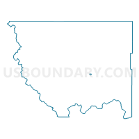
Outline

Summary
| Unique Area Identifier | 687720 |
| Name | Copple Voting District |
| County | Okanogan County |
| State | Washington |
| Area (square miles) | 0.68 |
| Land Area (square miles) | 0.68 |
| Water Area (square miles) | 0.00 |
| % of Land Area | 100.00 |
| % of Water Area | 0.00 |
| Latitude of the Internal Point | 48.42626400 |
| Longtitude of the Internal Point | -119.52323800 |
Maps


Graphs
Select a template below for downloading or customizing gragh for Copple Voting District, Okanogan County, Washington


Neighbors
Neighoring Voting District (by Name) Neighboring Voting District on the Map
- Coleman Butte Voting District, Okanogan County, WA
- Fiker Voting District, Okanogan County, WA
- Omak 10 Voting District, Okanogan County, WA
- Omak 11 Voting District, Okanogan County, WA
- Omak 6 Voting District, Okanogan County, WA
- Omak 9 Voting District, Okanogan County, WA
- Ross Canyon Voting District, Okanogan County, WA